Friday, August 12, 2011

Some of the Ridgeway and Thames Path

I am just back from a five days stroll along the Ridgeway and the Thames Path.
This was a very special hike in the history of my long distance walking: I had the pleasure to walk with both my daughters (Héloïse 24 and Beatrice 20) and, moreover, the last two days (on flat terrain) with my wife Chantal.

We set out the 3d of August from the East end of the Ridgeway on Beacon Hill (Buckinghamshire). The third day we left the Ridgeway about two kilometers after Watlington (Oxfordshire), and through various footpaths, we arrived at Wallingford where we met my wife (60 km from the beginning of the hike).

The following day we took the Thames Path northwards all the four and, after staying at a B&B in Sutton Courtenay, we got the following day to Oxford (the last few km by bus): the end of our journey.

We had only one day of very bad weather with rather heavy rain all the day long. My Goretex trail shoes (Innov-8 Rocklight 318 GTX), although meant to be waterproof, were soaked after only two hours! I am wondering whether it could be possible to find a lightweight shoe really waterproof!

We enjoyed the Ridgeway: varied  landscapes and gorgeous beech woods where we caught sight of squirrels and red kites.
On the contrary, we didn't like so much the Thames Path (at least the stretch we walked). We found it quite monotonous.

GEAR

I can boast to have improved my quest for ultra light walking. My rucksack with food and 1l water was only 4 k.

I learned that, at least in such populated country as Buckinghamshire and Oxfordshire, I can further reduce the food to a minimum emergency ration.

In this hike I had previously reserved the accommodation for all the legs, so I didn't carry the mattress nor the tent pole and stakes although I brought the tent because it works as a poncho as well. This, saved me a kilo.

One last detail: my Murmur, an ultra light rucksack by Gossamer Gear, has got too long shoulder straps for my size (it is made in only one size). The designer is a tall American while I am a rather short Mediterranean.
So the sternum strap is too low and the weight doesn't distribute perfectly. I will then be obliged to make some modifications.


Number in Number Weight Total weight Total weight
Item Rucksack Worn per unit Worn in rucksack
Camera
1 121 121 0
Camera battery charger 1
101 0 101
Camera battery spare 1
15
15
Canteen 1
29
29
Cell phone
1 77 77 0
Cell phone battery charger 1
43 0 43
Cleenex 2 1 27 27 54
Cutlery 1
39
39
Documents (maps, accommodation, timetables, etc.) 1
139 0 139
Fleece light (Montane) 1
231
231
Fleece light Active (Montane)
1 257
257
Food (rice cakes, dried fruit, sesame crunch) 1
715
715
Hat
1 107 107 0
Holdall (A.M.K. Bivvy Compression Bag) 1
7
7
Jacket 1
421
421
Medicine 1
56
56
Notebook
1 32 32 0
Orthopaedic insoles 1
90 0 90
Pants 1 1 28 28 28
Pen
1 13 13 0
Poncho-Shelter 1
323 0 323
Power adapter 1
39 0 39
Rucksack (Gossamer Gear – Murmur) 1
202 0 202
Sewing kit 1
8 0 8
Shoes
1 636 636 0
Socks 1 1 78 78 78
T-shirt 0 1 134 134 0
T-shirt (in cotton for sleeping) 1 0 118 0 118
Thermometer-Compass
1 10 10 0
Toilet paper 1
44 0 44
Tooth brush 1
15 0 15
Torch
1 9 9 9
Walking trousers
1 374 374 0
Wallet
1 143 143 0
Water 1 l. 1
1,000 0 1,000
Total (in grams)


1,668 4,061


PROJECTS

I am thinking to embark, at the end of August, on an old project: walking from my home town (Città di Castello in Umbria) to Florence. I am studying the best route: otherwise than UK, Italy is a very poor country in public footpaths (see my very first post on this matter).


Tuesday, May 31, 2011

A (Sadly) Curtailed Hike along the South West Coast Path


Being retired since the beginning of this year, I was pretty enthusiastic to be able, at last, to set out on longer hikes than my previous ones, limited to the holidays.
So, last week, I flew to Bristol in order to embark on a 12 days hike along the South West Coast Path, from Padstow (Cornwall) to Minehead (Somerset) (270 km).

Unfortunately, at the end of the third leg, I didn't feel well at all. I don't know if it was due to the effect of the oceanic iodine (I suffer of a light hyperthyroidism) or to the exhaustion (it is a really tough path) or a combination of both or whatever.
I was a bit concerned about the symptoms and, anyway, I didn't feel in the mode to continue the trip any further. Thus I went to Bristol and flew back home.

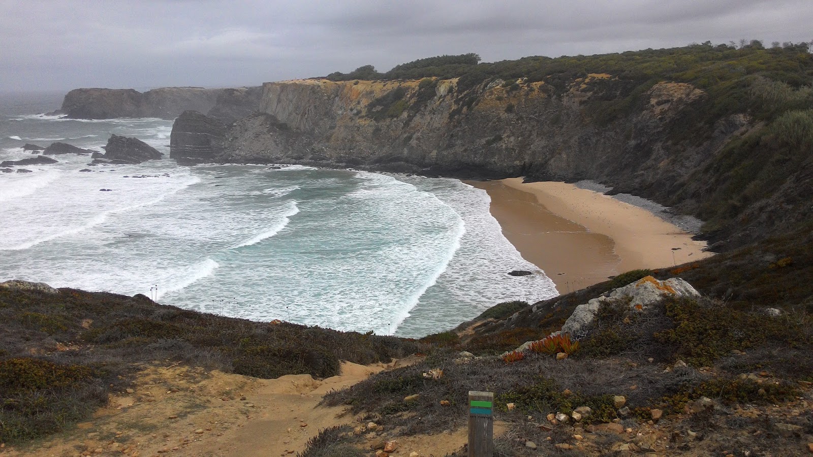
On the whole I walked a little bit more than 50 km, from Padstow to Crackington Haven, stopping in Port Isaac, Tintagel and Crackington Haven.

I must confess that although the coast was pretty gorgeous, I am afraid that after a few more days I would have found it a bit monotonous.
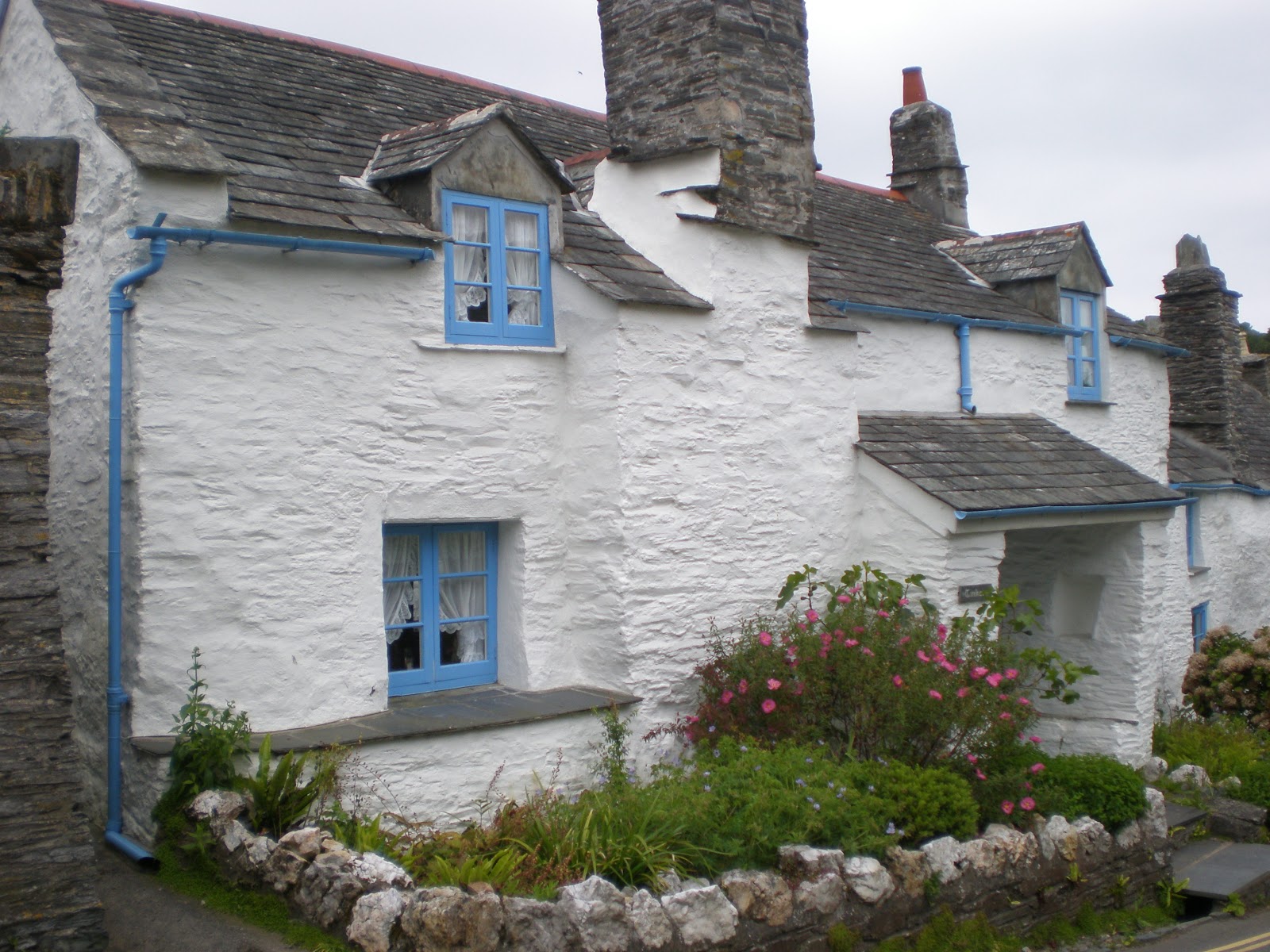
I found the North Cornish Coast rather similar to Pembrokeshire (I mean the coastal landscape) but more affected by tourism. So, even if Cornish villages are definitely nicer than Welsh ones, I liked better the Pembrokeshire Coast Path: I am keen on unspoilt area.


Mind you, gentle reader, the SWCP is really very tough. The coast is generally high but, at any stream (and there are so many), the path drops abruptly down to sea level and then rises steeply again. But what makes it definitely exhausting is the shape of the path. Very often, instead to go up and down in hairpin way in order to have a more gradual ascent it goes straight on and, moreover, often through very high steps. The knees get hurt going down and the muscles strain quite hard during the ascent.

ABOUT THE GEAR

The main difference between the gear I carried in this last hike and that of the previous one (see Cévennes) concerns mattress and rucksack. I replaced the closed cell foam mat (Z-Lite) with an air mattress (Thermarest Neo Air) which is about the same weight but, being very compact when deflated, has the advantage to fit in a smaller and lighter rucksack. So I replaced the Golite Jam-2 rucksack (51 l. and 700 g.) with Gossamer Gear Murmur (35 l. and 202 g.) which, besides being pretty lighter, is definitely more comfortable because its better weight distribution.
Moreover, in my quest for the ideal ultralight walking, I saved some more weight dropping mug, fuel, lighter and instant coffee: studying the map I realized that even if I had to camp I could soon find a place where to have a coffee in the morning; which for me is sacrosant.
But although I saved some hundreds of grams, eventually, the total weight I carried was nearly the same as that of the previous hike. In fact, having planned to walk many more days I carried much more food.

A doleful remark: my Innov-8 Rocklite 318 GTX trail shoes have once again revealed some flaws.
Firstly one cushion collapsed on the inner side causing a light inflammation to the foot and the ankle.
Secondly, although due to their Goretext membrane they are advertised as waterproof, after about two hours of moderate rain my feet were thoroughly soaked. Luckily, at the inn where I stayed, the heating was working!

So if there is any walker luckier than myself in finding a really waterproof light shoe, I beg him to tell me about it.


PROJECTS

I have already organized for next August a six day hike along part of the Ridgeway and the Thames path with my daughters and my wife.

For the next solos I am considering GR 7 Alpujarras section. I would like to go there when the almond trees are in blossom but I am wondering if in February, at about 1000 m., it is not too cold to camp. So, once again, if some gentle reader has been there, please tell me about.

In Autumn I would like to hike from Città di Castello (where I was born) to Florence (where I have spent the most important part of my life). There is not a well defined trail. One has to design it oneself and there are many choices about the route to follow.
One simple, but tough and probably not the most beautiful route is to climb to the top of the Apennines directly from Città di Castello (about 15 km.) and then follow the ridge up to Florence region where to drop into the city.
An other route, which seems to me more attractive, is to follow the river Tiber up to Monterchi than to pass by Anghiari, Caprese Michelangelo, Badia Prataglia, Vallombrosa. Then drop down to the stream Sieve from where to climb to Settignano. From Settignato it is possible to catch a bus for Florence or follow a large footpath with many steps which goes down to Rovezzano in the outskirts of Florence.

Friday, October 01, 2010

From Velay to Cévennes - Variations on Stevenson's Trail and Régordane Way


The Régordane Way
INTRO

I am just back from a six days southbound hike over the Eastern side of French Massif Central, from Haute Loire to Gard, through Lozère.
Since I started long distance walking in September 2007, this is the first time I have hiked outside Great Britain. One might wonder why.
Well, among the rational motives, I would only mention that, from abroad, is pretty much easier to plan a long distance walk in Britain than in France; in particular, because there are more and better on line resources (I have already explained why I don't hike in Italy).

The special feeling I have with Old England and the unique and unforgettable experience of my first long hike (Norfolk) can definitely be reckoned among the most relevant inspirations.
It might seem incredible but the only European country which I find quite outlandish is the selfsame England!
Apart from the difference of language, I feel quite familiar in France, Belgium, Germany, etc while, in England, it is almost as I lived in a romance or a novel of old. Probably, there are also other inexplicable reasons.
But, I am going astray, back to the matter!


A SHORT DESCRIPTION OF THE HIKE

I would have liked to walk the whole Stevenson's Trail (252 km.) or the Régordane Way (240 km.) but I had only one week of vacation available so I made a kind of short melange: some stretches of the above ways mixed with other trails or country lanes or even roads.

The Cathedral of Le Puy

I set out from Le-Puy-en-Velay on Monday, 12 September and walked 19 km. of the GR 430 (GR: grande randonnée i.e. long distance trail) up to Le Monastier-sur-Gazeille in Haute Loire (where I spent the night at the Auberge des Acacias, a small neat and lovely hotel. € 45 en suite b.i.).
In the train from St. Etienne to Le Puy there where a lot of walkers but, probably, most of them were bound to San Iacopo de Compostela: I met very few hikers along my route.
An over-sixty lady takes place in front of me and, as we both carry rucksacks we soon start chatting. She is just retired and she is going to Compostela (1,500 Km.). I feel a tender compassion glancing at her huge and heavy rucksack. She is even wearing sandals, carrying a pair of boots in the rucksack which I reckon to be weighing over 15 Kg.! It is her first long distance walking; I try to give her some advice on the importance to be as light as possible and she says that she will probably ship back home some gear if she realizes to be unessential. I wouldn't seem an ultra-light-backpacking evangelist but, as I read on a French web-site on the topic: "A heavy rucksack is a rucksack crammed with anguish - Freud"


The Loire at Goudet
On Monday, 13 September I walked from Le Monastier-sur-Gazeille to Landos (less than 25 Km.), crossing the Loire at Goudet. I followed the GR 70 (Stevenson's Trail) up to Ussel. Then I got to Landos shortcutting by country roads. Mind you: from Stevenson's booklet A Travel with a Donkey in the Cévennes, we know the places where he went but not the ways he took.
Therefore the official route is a sort of hypothetical reconstruction to which one shouldn't feel obliged to stick too strictly.
So from Ussel I followed the D 491 (D stands for Départementale: numbered local road) where cars passed each quarter of an hour. Eventually, through the D 88 I got to Landos where I stayed at the Gîtes d'étape communal (a sort of youth hostel managed by the town council). For € 12 I had the luxury of a four beds en suite room (with kitchenette) only for me (few people walking in the area in September).
Landos is a small village but there is a nice romanesque church with "comb belfry" (clocher à peigne) typical of the area.

Régordane Gate at Pradelles
On Tuesday, 14 September I set out from Landos and again I took a non canonical route shorter than the Régordane Way. I reached the latter at Les Uffernets and then I sticked to it as far as Langogne (19 Km.). I stopped for a meal at a rather shabby restaurant in Pradelles, a nice though austere mountain stone village. In Langogne I stayed at the "Modest Inn" (the pun should sound familiar to the reader of the mentioned Stevenson's booklet: Modestine being the she donkey who carried the writer's pack). It is a full of books chambre d’hôte (i.e. B&B) run by Philippe, a nice southern Frenchman. I had my breakfast with a couple of French walkers I met again along the route.
Langogne Grain Hall
In Langogne, at last, I could buy a pair of insoles: I had forgotten to insert the original ones in my shoes before leaving home and in the long run it hurt! Actually it went even worse because the insoles I found didn't breathe and I soon got blisters!

Wednesday, 15 September. Cold (8° C.) but beautiful crispy blue sky. Perfect for walking. I climb from Langogne through pastures, then, I walk mainly through forests on the uplands (over 1,000 m.). Soon I leave the Stevenson's Trail and follow the Régordane Way. A short rest, the time to eat some plums and cheese. Suddenly the air and the flora change; I am now on the Mediterranean side; the ground is dry, more similar to Italy.
At Luc castle I met the couple of this morning breakfast. We take photos and we stop for a coffee at the local café. They move on before me: they want to stay at Notre-Dame-des-Neiges, like Stevenson. I walk leisurely directly to La Bastide where, for € 44,00, I take demi-pension (half-board) at Les Genêts, a basic, neat and functional hotel. The today leg has been of about 23 Km.
The hotel is full of middle-aged walkers, probably doing circular hikes in the area. I chat with a Frenchman from Strasbourg who is walking the whole Stevenson's Trail. He carries a rucksack weighing more than 12 Kg.! He seems a bit puzzled when I tell him that mine is no more than 5,5 Kg. water, food and camping gear included.

La Garde-Guérin
Posing with Savoyard Hikers
Thursday, 16 September. After La Bastide, I walk at last, on the true Régordane Way: a trail excavated on the stone with evident cart tracks which the legend (Le Charroi de Nîmes) ascribes to the passage of Guillaume d'Orange, with a cart full of armed men, directed to reconquer Nîmes (see first picture on this post). I stop for a bite at rustic B&B (Albespeyre) where I share the table with two couples from Savoy. It turns up that the men are two brothers of Italian stock. Descendants of old emigrants from the Italian Alps (near Bergamo). We have a nice and friendly chat and we discuss even the present distracted times of Italian politics. I pose with them for a photo. They start before me but I meet them later at La Garde-Guérin, a lovely medieval walled village.
Eventually, I spend the night in a pretty shabby hotel at Villefort, where I arrive exhausted after 22 Km. of walking manly on loose stones tracks. I am so tired and disheartened because of the pain from blisters ache that I am resolved to finish there and get the train to Nîmes the following morning.

The Cévennes
Friday, 17 September. The arnica ointment has done miracles: nearly no more pain from the blisters! So, I decide to continue the hike. But, instead of following the Régordane - which now runs mainly on a valley - I take the GR 68. I climb the steep ascent to the ridge where wonderful views open over the Cévennes. A sea of mountains and forests as the eye can see!
On the ridge the going is easy: always on tracks but for the peak of Le Bousquillou (1,115 m.) where I have some trouble in finding the path among dense brooms and in scrambling a rocky descent. At the end of the scramble I meet three middle-aged ladies bound to Villefort who ask me information about the difficulties of the route.
Eventually, in the late afternoon, after a very strenuous descent on loose stones mule track, I get to Génolhac: the end of my journey.
Génolhac
The leg (c. 25 Km.) has been particularly hard but worthwhile: probably the best of the whole hike.
I find a room at the at Le Commerce (€ 32 w.b.), a basic hotel where I feel back to the fifties.
 
All the following day I am excrutiated by a violent headache: too much gluten in French breakfasts? Sadly I cannot enjoy the lovely and lively city of Nîmes where I spend the afternoon before going to catch my flight at Lyon Airport.


LONG DISTANCE WALKING IN FRANCE AND BRITAIN COMPARED

It is probably wrong to compare but I cannot resist to put down some reflections I made on my journal.
The landscape I saw in this French hike is probably more varied (I am starting with the positive aspects) than the average one I saw during my walks in Britain. The weather is definitely drier! Grocer's shops are easier to find and, generally, they are better-stocked.

On the other end, while British villages are almost always well kept and harmonious, in the French area where I have walked the villages are a bit like in Southern Italy: old splendors mixed with buildings of any shape and style.

There are other aspects similar to Italy. During my hike in France I have never walked a path in a meadow among cattle or flocks nor in any evident private land. In Britain, even let alone the special custom of Scotland, one walks mostly on private land. The right of way seems something impossible in France or Italy. Probably, while in Britain there is a consolidated awareness of the citizen's respect for other's property, in France as in Italy there is a sort of mistrust and jealousy of landowners who, at least in the latter country, tend to obstruct even public footpaths (see the relevant topic on old post).

An other difference I have noted concerns wildlife: I have seen in France very few animals; it is like they were scared by humans. Besides, in some area, there were many hunters.
British dogs are different as well: in Britain I have very seldom heard barking while in France, like in Italy, each time I passed near a house or a farm I was welcome by furious barking. I passed even before a farm from whose open gates got out two big nasty looking dogs advancing towards me with threatening mien. Luckily they stopped in front of my aggressive insults!

Public transport is sparser in France than in England. Trains are equally expensive but, in Britain, one has the resource of a dense network of relatively cheap coaches and buses.
The I.G.N. 1:25 000 maps are fine but, apart of named trails (GR, GRP and PR) there isn't any indication of right of way. Ordnance Survey maps trace in green any right of way, even related to the smallest footpath.

In Britain there is such a wealth of on line information that planning a hike goes on so smoothly!
Let alone National Trail web site, one can find descriptions, maps, leaflets, etc for a huge number of other trails; from a couple of hours stroll to a thousand miles hike.  Let me only mention The Long Distance Walkers Association which, among other things, allows you to find walk through various queries, combining distance, area, etc.
Nothing comparable exists for French trails. Even planning hikes from scratch it is not that easy. Actually, IGN (Institut Géographique National) allows only text search for its 1:25 000 maps (by town or place or grid reference). Sadly, no visual search on scalable maps is available, as at Ordnance Survey. The only tool that might help is ITINERAIRES DE GRANDES RANDONNEES EN FRANCE, a 1:1 000 000 map showing all the long distance trails of France.

I hope I have not been too biased in my comparison. Anyway it has been a wonderful hike!

THE GEAR

When I look back to the 8 Kg. gear of my first long distance walk, I can appreciate the progress I have made along the way to ultra light backpacking: on this hike I have carried a rucksack a little bit heavier than 5 Kg. but with camping gear included and the luxury of Stevenson's booklet.
For more details you can look at list below and compare it with that of my first long distance walk.
Let me add here just some comments about the lightening process which results from my experience and that of others as well.
  • Eliminated anything not absolutely indispensable: map case, pedometer, pyjama, shorts, spare glasses, emergency blanket, shirt, dental paste and floss, dried apricots and sesame bars.
  • Reduced the number of items: 1 t-shirt instead than 2; 2 pants instead of 5; 1 ricecakes packet instead than 2; 2 pairs of socks instead than 6.
  • Replaced some articles with less heavier ones: Quechua heavy fleece (551 g.) by Montane Prism 2.0 Jacket (420 g. and windproof extra!); Quechua 40 l. rucksack (1,800 g.) by Jam 2 Golite (51 l. 700 g.); Quechua torch (75 g.) by Photon Micro-Light II LED Keychain Flashlight (9 g.).
  • Replaced two items by one multifunction item: e.g. waterproof jacket and rucksack rain cover by a poncho.
Now, if somebody took pains to calculate the balance between the two configurations he would find more than only 3 kg. The early greater difference, due to the above lightening process, has been reduced by the items I have been obliged to add in order to camp. Beside, the mentioned poncho (wich actually works as a tent as well) now I carry also: tent harness, pole and pegs; metal mug; solid fuel tablets; lighter; mat (which works as rucksack stiffner as well);  sleeping bag; towel; an extra fleece for cold nights camp and, finally, thermometer-compass.

For the sake of details eager backpackers or of anybody else, I conclude this post with the list of gear I have carried during this last hike.

Item Weight per unit Number worn Number in rucksack Total weight worn Total weight in rucksack
Camera 121 1
121 0
Camera battery spare 15
3
45
Canteen 29
1
29
Cell phone 77 1
77 0
Cell phone battery charger 43
1
43
Chocolate bar 106
1
106
Cleenex 27 1 1 27 27
Coffee (instant) 2
10
20
Cutlery 39
1
39
Documents (guides, maps, etc.) 424
1 0 424
Fleece light (Montane) 231
1 0 231
Fleece light Active (Montane) 257 1

257
Hat 107 1
107 0
Jacket (Montane Prism 2.0) 421
1
421
Lighter 10
1
10
Mat (Thermarest Z-Lite) 387
1
387
Medicine 120
1
120
Mug (Tibetan Titanium 450) 75
1 0 75
Notebook 32 1
32 0
Pants 28 1 1 28 28
Pen 11 1
11 0
Poncho-Shelter (Gatewood Cape) 323
1 0 323
Rice cakes 124
1 0 124
Rucksack (Golite Jam 2) 700
1 0 700
Sewing kit 8
1 0 8
Shoes (Inov-8 Roclite 318 GTX) 636 1
636
Sleeping Bag (W. Mountan. HighLite) 499
1 0 499
Socks 78 1 1 78 78
Solid Fuel (Esbit) 85
1 0 85
T-shirt 134 1 0 134 0
Tent Harness 20
1 0 20
Tent Pegs 10
6 0 60
Tent Pole 55
1 0 55
Thermometer-Compass (Recta Micro) 10 1
10 0
Tooth brush 15
1 0 15
Torch (Photon Micro-Light II) 9 1
9 9
Towel 48
1 0 48
Walking trousers 374 1
374 0
Wallet 143 1
143 0
Water 1 l. 1,000
1 0 1,000
Total (in grams)


1,666 5,286

Saturday, July 31, 2010

Wandering through Cheshire

Chester - B&W Houses


At last I am back again!

I have been silent for quite a long time. I usually set out for a long distance walk two times a year. Sadly, because various illnesses, I haven't been able to walk since Spring 2009.


A new (for me) way of walking

This last stroll has been quite different from the previous ones (note, by the way, the term "wandering" of the title): I have tried to shift the focus from the goal to the action or, better still, as the father of backpacking says:

For my part, I travel not to go anywhere, but to go. I travel for travel’s sake. The great affair is to move; to feel the needs and hitches of our life more nearly; to come down off this feather-bed of civilisation, and find the globe granite underfoot and strewn with cutting flints. [R.L. Stevenson, Travels with a Donkey in the Cévennes].

In the previous hikes the end of the trail was my goal and, moreover, I was obliged to stick to the planned legs, being bound to the accommodations booked long time before.


In the end, I have found that that approach spoils somehow the pleasure of walking. So I decided that, first of all, I should get rid of the reservations constraint. Therefore I changed my gear in order to be able to camp anytime I couldn't or wouldn't spend the night at some accommodation.

I was determined, if not to camp out, at least to have the means of camping out in my possession; for there is nothing more harassing to an easy mind than the necessity of reaching shelter by dusk, and the hospitality of a village inn is not always to be reckoned sure by those who trudge on foot. [R.L. Stevenson, Travels with a Donkey in the Cévennes].

Apart from the night I arrived from Italy, I didn't book any accommodation at all. So, I was able to change my route or to finish the leg as the whim took me.


In fact, I camped only once; the other ones I found some kind of accommodation.


The Gear

Obviously, this change of method and my quest for lightness, have driven me to modify my gear.

Shelter

Following the multifunctional ultralight approach, I didn't choose a tent (regardless of its lightness) but something that could also work as a waterproof: a cape-tent.
Gatewood Cape set up as a tent
Gatewood Cape set up as a cape
As the photos show I used the Gatewood Cape by Six Moon Designs which works as a tent and a rainproof cape as well, for less than 400 grams, pole and stakes included.
It resisted the rain but a lot of condensation during the night; I need to learn staking the front line for better ventilation.
On the whole I am happy with this gear and I will continue to use it.

Sleeping bag

I wanted to find something lighter than a traditional sleeping bag so I used Thermo-Lite 2.0 Bivy Sack by Adventure Medical Kits.
Very light (190 g.) but too much condensation. At 4 p.m. I was nearly wet.
So, for 265 g. more, I will shift to HighLite Sleeping Bag by Western Mountaineering (already ordered) rated to 2° C.
For summer and not mountain hikes, I will balance the weight dropping the second fleece I carried for sleeping.

Sleeping mat

I used Z-Lite, a closed-cell foam accordion-plying sleeping mat by Thermarest.
It provided also a back stiffener for JAM 2 rucksack by GoLite, which I had stripped of its back foam.
I am very happy with this mat: comfortable and incredibly isolating (even laid directly on damp forest ground).

Footwear

During the last two hikes (Pennines Way and South Downs Way) I wore mid Lowa Renegade boots. Absolutely waterproof and breathable but a bit too heavy (550 g. each).
So this time I used a lighter footwear (trail runner): Rocklite 318 GTX; very light (318 g. each), comfortable, high cushioning but less waterproof and breathable than Lowa Renegade.
I will nonetheless continue to use them unless hiking very wet tracks like Pennines or Scotland where I will put on Lowa again.

Miscellaneous

Waking up after a night in the cold and damp, one needs some warm beverage in order to get in good mood.
So, I carried a very light mug (Tibetan Titanium), solid fuel tablets and instant coffee. A rewarding weight: never enjoyed a hot coffee so much!

Short description of the hike

16 July 2010

S.U. Canal - Chester
From Chester to Bulkeley Hill, firstly along the Shropshire Union Canal then along the Sandstone Trail (23 km).


17 July 2010

From the Sandstone Trail
From Bulkeley Hill to Whitchurch, along the Sandstone Trail (20,5 km).

18 July 2010

Stuck in hotel (Whitchurch) waiting footwear and garments to dry!
I took a short-cutting footpath from the Sandstone Trail to Whitchrch, that, before getting to the town, ended in man high nettles and other weeds. There I fell head first into a knee deep dark slimy water of a ditch I hadn't seen because the tangle of weeds. I lost my glasses and I got to the town (trespassing a farm) all black smeared; a sort of alarming scarecrow! Luckily I found at once a basic hotel the landlord of which didn't fuss about my look.

19 July 2010

From Nantwhich (got there by train) to Winsford along the Weaver Way (24 km).

20 July 2010

FromWinsford to Northwich via Weaver Way (12 km).
From Northwhich to Delamere by bus.
Delamere Forest
From Delamere to Frodsham along the Sandstone Trail (14 km).

Conclusion

Honestly, the excitement of this hike came especially from the new approach (see above).
Delamere Forest is gorgeous, unfortunately I walked it under unrelenting heavy rain.
Canals are very interesting (locks, manoeuvring, etc.) and often quite lovely but, in the long run, they tend to be slightly monotonous.
Weaver Navigation between Northwich and Winsford is lovely but one must walk some miles in the ugly works area of the latter town.
Chester and Nantwich are pretty nice; the other towns I have seen in the county are colourless and, sometimes, even a little bleak. I think it depends of lack of old history or de-industrialization.
Lastly, with the exception of Chester, accommodation and refreshment along the trails are rather scanty.

Tuesday, April 28, 2009

South Downs Way

From the 6th to the 12th of April, I walked the South Downs Way from Winchester to Eastbourne.

The main novelty of this last hike is that I didn't do it solo but with my youngest daughter Beatrice.

Unfortunately, for lack of suitable prior training, we weren't fit enough. So, at the end of the 5th day we were so tired that we skipped the next leg (from Pyecombe to Lewes).

Apart from one whole misty day under heavy rain, we had always fine weather. Fresh but good for walking.

We met nice people and we stayed in beautiful inns and hospitable B&Bs.
As we advanced we were accompanied by the delightful song of skylarks and chaffinches.

I really don't know why but, in the end, I found the South Downs Way the less exciting of all the hikes I've done in Britain.

I took the opportunity of this last walking to improve the reduction of the gear weight.
I have gained 250 g. shifting from Ferrino Cumbre 35 l. rucksack to the Golite Jam2.
I found the latter less comfortable. But being frameless it needs something to stiffen it; e.g. a mattress which I didn't carry.
I gained some more grammes replacing the waterproof jacket and the rucksack cover by a poncho and a very light windproof.

Thus far I have always stayed in B&B or inns. In the future I would like to be more free and not to be bound to legs depending on accommodations booked longtime beforehand.
Therefore I am considering to carry a light camping gear: a poncho-tarp, a foam mattress and sleeping bag.
But, before embarking in a tough trek abroad (e.g. Highlands) I would like to do some experiments near home in order to stop easily in case something should go wrong.
So, next Autumn I would like to walk a section of the Apennines trail (Grande Escursione Appenninica) from the southern border of Tuscany to Florence.

As usually, I have taken some photos which are now available through the relevant links in the Trail Pictures section.

Monday, September 15, 2008

Pennine Way

I've just finished walking a section of the Pennine Way: about 100 km in 5 days.
My legs are still stiff and aching; I new it would have been tough or, at least, quite tougher than my previous hikes: Peddars Way and Pembrokeshire Coast Path.

It is for that very reason that I decided to do it as soon as possible: being over 62 my strength can but lessen.

Compared to the above mentioned hikes, I found the Pennine Way not only much tougher but pretty more difficult as well: route often hard to find, very boggy and even flooded paths.
I've got to add that, in order to reduce the number of days out, I stretched the legs to an average of 25/26 km; which on hills trails it revealed too tough for me.

Anyway, like the other hikes, I enjoyed this one very much and I'm quite happy to have done it.

Again I took a lot of pictures (more than 500); if you are interested, please, take a look at the gallery top-right. They are arrayed by leg.

In contrast to the other hikes I did, Pennine Way was also more "adventurous". Let me just recount some of the main relevant events.

In the afternoon of the first leg (Hebden Bridge - Cowling), when I was going down Ickornshaw Moor, my knees began to hurt so acutely that I couldn't even ply them and I was obliged to descend the hill walking sideways and quite slowly.
I was so exhausted that I was unable to find the track which, as a matter of fact, was not easy in the least. In that area, as rather often along the Pennine Way, the track is actually unmarked and the rare traces of other walkers were deleted by the water flowing everywhere after the last August heavy rains. The ground was so boggy and wet that one had to mind carefully each step.
The pain to the knees was due particularly to the lack of prior training: August having been too hot at home. The general exhaustion was the result also of a too long first day on the hills (26 km plus 2 more because lost track detours) and of a beginning of dehydratation (I had sweated a lot wearing waterproof vest and trousers because the heavy rain ).

In short, as the day was starting to wear away, I began to fear of passing the night on the moor wrapped up in my safety blanket!

Luckily Mike, an Irish walker living in Scotland, came up and was so kind as to help me walk up to the evening goal.
I am very grateful to Mike whom I met again several times in the following stages and I'm sorry that he couldn't end his journey because a severe blister.

While my other hikes were quite solitary, walking the Pennine Way was a pretty sociable event: I met several walkers some of them I became friend with. Beside Mike, already mentioned, I want to remember Steve and, particularly, Roger and his son Thomas who helped me to find the track I had lost over Malham Cove. Although I usually walked alone because difference of pace, I often met them again at the B&Bs and inns.

Actually, the Pennine Way is partly an "invention". I mean that beside traditional more or less clear trails there are places, especially on the moorlands, where often there is no path at all.
There, one has to track other walkers' traces or relay on points of references (when available) or use a compass.
Sometimes, while the Pennine Way is barely perceivable, one meets secondary paths definitely more distinct which lure astray.
It is just what happened during my first leg, when, climbing towards Clough Head Hill, I loosed the track taking the only visible path on the right which, actually, bears away from the Pennine Way to the parking near the 68 road.
It was my first luck to meet soon a jogger which told me how to get to the Pennine Way again.

On Stonesdale Moor the Pennine Way faded away again and it was only thanks to the road across the dale - the only point of reference - that I didn't totally get lost.
Later on, when the dusk was beginning to fall - making me rather anxious - the thin smoke column of Tan Hill Inn, appearing in the immense and void sea of moorlands, was to me like the shore vision for the seafarer. I think I will never forget that epiphany.

Again, during the last leg, on top of Cotherstone Moor, the Pennine Way vanished. Luckily the weather was clear and I was able to point to the reservoir on the bottom of the dale where, after a careful walking through high tussocky grasses, I rejoined the Pennine Way.

I won't mention the other minor track missing occurred during the trip.

ABOUT THE GEAR

When I gave back the soaking low walking boots I had used on Pembrokeshire I bought, partly with the refund, a pair of Lowa Renegade GTX Mid which I had read many positive reviews about.
I was puzzled whether to use them because their heels were too high for me, making my legs pain. I was almost decided to take the New Balance NB985 I used one year before in Norfolk which, although very comfortable from the point of view of the set, are poorly breathable and low.
I knew that the ground would be very wet and boggy so I rasped the Lowa heels in order to get a better set.
It proved to be a quite sensible choice: after three days of heavy rain and a week of walking on often flooded and very boggy paths, my feet remained always dry! With the New Balance I would have got my feet quite soaked.

On the windy and cold tops of the hills I realized that there is no need of a heavy fleece: in my next trip I will replace it with a second light fleece to wear, in case, over the other one. I will be able thus to spare some more weight and space.

My waterproof vest leaked around the right shoulder and, like the over-trousers, it is not breathable. This makes a lot of moisture climbing the hills: I am going to look for breathable waterproof garments; if they exits.

SOME LEARNED LESSONS

I must not start without a suitable preliminary training.

On hill trails I must limit each leg to a maximum of 20/22 km.

TIMELINE

September 5, 2008. Getting there

Flown from Rome-Cimpino to Liverpool. Got to Manchester by coach. Light lunch at the Soup Kitchen. Reached Hebden Bridge by train in the afternoon. Accommodation at the splendid 17th century old White Lion Hotel Inn.

September 6, 2008. From Hebden Bridge to Cowling 28 km (with detours)
Short visit to Hebden Bridge waiting for breakfast time.
Starded the walk under rain.
Lost track around Green Hill. Found again thanks to a jogger's help. Round 1 km detour.
Exhausted and painful knees (impossible to ply) on the afternoon over Ickorshaw Moor on flooded and boggy undistinguishable track. Got to Cowling thanks to Mike's help (Irish walker from Scotland).
Gone to bed without supper (too exhausted) at Susan & Sandy Black B&B: quite charming people.

September 7, 2008. From Cowling to Malham (by bus)

Need of rest. Got to Malham (planned stage) by busses (3). Warm soup at the local café. Checked-in at Beck Hall; nice B&B in an old building along the beck. Little walking to visit Janet's Foss and Gordon Scar (5 km). Dinner with a plate of vegetables at the local pub.


September 8, 2008. From Malham to Horton-in-Ribblesdale 23 km
Climbed Malham Cove where lost the track; found again thanks to Roger and Thomas. Climbed Fountains Fell (660 m.) under rain. Little trouble with cattle during snack halt. Climbed Pen-y-Ghent (694 m.) with rather fine weather. Got to Horton-in-Ribblesdale tired but not as in the first day. Crown Hotel very nice old inn where I had a drink with the other walkers already met: Mike, Steve, Roger and Thomas.

September 9, 2008. From Horton-in-Ribblesdale to Hardraw 24 km

Rain during half day. Climbed Dodd Fell (600 m.). Walked in thick mist during 3 hours: luckily clear track and clear weather again on the moor before Hawes where the way is trackable only looking carefully for recent traces of other walkers. Cake and Coffee in Hawes, nice town. Dinner with a bowl of chips and a bitter at the Dragon Hotel where I stayed: beautiful old inn whith fire in the bar and in breakfast lounge. Long chat with charming customers.

September 10, 2008. From Hardraw to Tan Hill 26 km

Fine weather all day. Climbed Great Shunner Fell (716 m. the highest of my trip). Met a lot of walkers, even a girl on solo. Coffee and cake at Keaton Hotel in Thwaite around 13:00. Very tired. Little anxiety on Stonesdale Moor where the path fades away. Bearing thanks to the road visible on the left. Got to Tan Hill a bit before dusk: quite relieved. Tan Hill Inn very nice old inn with fire and charming landlord; celtic music. Met Roger and Thomas for the last time being their trip end. Roger offerd me a whisky: very nice. I was alone in the bunk house; need to pass by the kitchen in order to get there. Windy and rainy night; little discouraged, almost made up my mind to give up the last leg.

September 11, 2008. From Tan Hill to Middleton in Teesdale 26 km

Poor breakfast; no cerals, nor toast, nor butter and jam either; only one mug of lukewarm coffee. But the very dark brew and no forecasted rain cheered me up and set forth.
Got the route alternative to the track along the beck: dangerous in bad wheather. Lot of grouses. Lost the track at Through-Heads; entered a farm court; climbed over a locked gate hurting the knees hopping down. Extremely tired all day long. Lost track on Cotherstone Moor; luckily good visibility so no need of compass: walked through the high grasses of the moor, bearing towards the reservoir in the bootom of the dale. Got to Middleton arond 6 p.m. Went to bed after hot shower, without supper: too tired. Brunswick House quite lovely and refined B&B; forniture and food as well. Middleton looks like a fine town too.

September 12, 2008. Going home

Smooth trip to Newcastle by bus and train. Went to Marks & Spencer to buy pure wool pullover for Chantal. Got to the airport very early: alas, too tired to visit Newcastle which looks like a really alive and charming city.


Sunday, May 04, 2008

Pembrokeshire Coast Path

Well, at last I've been able to realize the "dream" I had been fostering for two years: walking the Pembrokeshire Coast Path.
In the very beginning of my long distance projects, I was a bit intimidated by the toughness of the path and its remoteness from Heathrow. So, as my first long distance walking experience, I chose the Peddars Way and Norfolk Coast Path which revealed a wonderful trip as I related in previous posts.
Although quite different, I found the Pembrokeshire Coast Path too, a magnificent hike. But more about that below.
In contrast with the previous hike, I won't transcribe here the journal kept during the last trip; I don't consider it of much interest for the reader. So I'm just giving a short summary.
I took more than 900 pictures; if interested, please, take a look at the gallery top-right. They are arrayed by leg.

TIMELINE

April 19-20, 2008. Getting to Wales

Landed to Heathrow (from Rome) in the late evening, just in time to catch the midnight National Express coach bound to Swansea. There - being Sunday - waited from 4 am to 10,30 for the first train to Haverfordwest. Town tour, dinner. Accommodation at College Guest House.

April 21, 2008. From Marloes to Broad Haven 25 km

9,00 Bus from Haverfordwest to Marloes where arrived at 10,05.
Lost a little time in finding the public footpath to the coast.
Started the Coast Path walking at Ragged Rocks (Marloes Sands) around 11 pm.
Half an hour break around 1,30 pm (after Musselwick Sands) for refreshment (water, chocolate, rice cakes, dried apricots and sesame bar).
An other short break 3 miles before the goal.
Reached Broad Haven around 6 pm. Accommodation at Anchor Guest House (nice).
Supper in my room with cheese and apples. Half bitter at the local pub.
Beautiful weather all day.
Very exhausted and knees hurting during the last miles.

April 22, 2008. From Broad Haven to Lower Solva 18 km

Waken up during the night with strong headache (persisting all day long). Drunk juice of 3 lemons bought in the local shop (my favourite remedy for headache due to gluten).
First break around 1,30 pm (with light refreshment as above) plus a second shorter one later.
Got to Solva in the afternoon.
Accommodation at Gamlyn B&B, nice cottage along the River Solva.
Supper with apple and rice cakes.
Beautiful weather all day.
Very tough leg although shorter then the previous one: many steep hills to climb.
Come across an adder coiled in the middle of path.
Met scanty walkers; mostly short distance.
A little trouble with the cows barring the passage after a stile. Not seeming that peaceful, made a dangerous detour passing on the verge of the cliffs.

April 23, 2008. From Lower Solva to St David's 23 km

Headache almost gone.
Start walking around 9 am.
Beautiful weather all day after a bit overcast in the early morning. When sheltered from wind even hot. I got sunburnt on the neck and nose. A sun hat would have been appropriate.
Break half way on the verge of the cliffs with usual refreshment contemplating an astonishing view.
Got to St David's through never ending 2,5 miles of roads.
Accommodation at Y-Gorlan Guest House; very nice and refined.
Pain to a heel tendon. Application of Arnica Heel ointment (vanished overnight; I recommand it as the walker companion!). Started to assume Rhus Toxicodendron against possible tendonitis.
Nice town for Wales standards. Interesting cathedral although very renovated.
Emotion hearing in the cloister a soprano rehearsing a Haendel (?) aria with piano accompanist.
For supper bar food at the local pub a little spoiled by the huge TV broadcasting the match Manchester-Barcelona or whatever.

April 24, 2008. From Whitesands beach to Abercastle 25 km

Got to Whitesands parking by bus. Start walking 9,45 am.
Still exceptionally fine weather. Tough path too, with many steep climbings.
Break about 1 pm with refreshment as usual.
Coffee break around 3 pm in Porthgain.
Garn Isaf B&B room unavailable because delayed works; instead I had the self catering cottage all for myself!
No pubs near: light supper with caffelatte and rice cakes.

April 25, 2008. From Abercastle to Goodwick (Fishguard) 26 km

Bad day: heavy rain all time. Boots and trousers soaked. Many steep hills to climb and often on difficult path.
Short break around 1 pm roughly sheltered in an unfinished sort of building.
Troubles with cows barring the passage: detour by the cliff edge.
Accommodation and dinner at The Ferry Boat Inn. Nice and good quality.
Dried boots and other wet garments over the heating.

April 26, 2008. From Fishguard (Lower Town) to Newport 22 km.

Got to Fishguard from Goodwick by bus.
Bought the only waterproofer available in Fishguard (for my shoes).
Started the walking from Lower Town reached by bus.
Halt about 2 pm in Pwllgwaelod (coffee and carrot cake in the local pub). Very tired: probably accumulated fatigue.
Lovely weather all day.
Accommodation at Golden Lion Inn. Nice place; unfortunately no shower, only bathtub. Supper at same inn bar. Chat with nice customers. Very animated (Saturday night).
Newport is the nicest town seen in Wales (thus far). Stone houses, Gothic church, castle remnants, burial chamber.


April 27, 2008. From Newport to Moylgrove 16 km.


Accommodation at Swn-y-Nant B&B in Moylgrove. Nice and good quality. Supper with cheese and fruit.
The waterproofing of shoes useless: socks damp after a few steps in the dew wet grass.
Luckily fine weather all day.

April 28, 2008. From Moylgrove to St Dogmaels 16 km

God weather.
Coffee break with welsh cakes at Webley Hotel.
Reached Cardigan by bus.
Accommodation at Highbury House. Breakfast not particularly good although nice place and landlady.
Supper in a pub near the bridge on the river Teifi.
Cardigan is a pretty animated town.

April 29, getting back home

9,00 am bus from Cardigan to Carmarthen, then National Express to Swansea and another NE coach service to Heathrow where arrived at 17 pm. 8 pm flight to Rome. Landed 12 pm.

IMPRESSION OF THE TRIP

Very beautiful trail. I was astonished to find a so long stretch of coast quite unspoilt. Impossible to find an equivalent in Italy.
I'm glad to have chosen this time of year because not too hot for walking and especially because the full blossom. Magnificent carpets of gorse, hawthorns, violets and primroses.
Caught sight of a seal (from very far). Many birds and - particularly dear to me - skylarks, whose song was my enchanting companion during the whole hike.
Some troubles with the cows (see above). Seen many horses, wild welsh ponies and, quite unexpected, an adder.
Exceptional fine weather (only one rainy day).
A tough hike on the whole. But, notwithstanding the National Trail Guide, I could have walked the Newport - St Dogmaels leg in one day instead of splitting it in two.
As I couldn't afford to stay away more than 10 days I wasn't able to walk the entire 300 km of the trail. So I chose to start from Marloes, skipping the oil refineries area between Pembroke and Milford Haven and then proceeding northwards.

PEMBROKESHIRE COAST PATH AND PEDDARS WAY - NORFOLK COAST PATH COMPARED

Well, it's hard to compare such different trails.
To begin with I must say that the Norfolk hike had the unique spell of the first time.
It was my first long distance walking experience and everything was magic to me.

Pembrokeshire Coast Path leads one through a long lofty stretch of colourful and almost savage scenery of high cliffs interrupted by secluded coves where crystal brooks flow into the wide Ocean.
You are often up and down on the Pembrokeshire Coast Path, reaching 175 meters over the sea level. What difference with the Norfolk Coast Path which progresses through a flat sea marsh landscape. Or with the almost straight line of the Peddars Way where the highest point is only 75 meters o.s.l.

The Norfolk trail is definitely less spectacular but, at least to me, it has its own spell: wide horizons, huge oaks and limes and dear ash trees, the magic intermingling of earth and water.

While the Pembrokeshire trail offers to the walker the grand feeling of an unspoilt, primeval and solitary landscape, in Norfolk - although in some stretches one might feel secluded - you are always in contact with the history of the Country: the footpath tracing a Roman road, old English villages and towns with beautiful flintstone Gothic churches, remnants of once splendid priories and ancient pubs where, enjoying a delicious local ale after your long stroll, you almost expect to see Tom Jones coming in.
Yes, in my impression, what lacks in Wales (at least in what I've seen of it) are beautiful old villages and tidiness of houses and countryside. Outside the path I've noticed a little shabbiness which unpleasantly reminded me of Italy.

If I had to resume my impressions I would say:

Pembrokeshire "colourful unspoilt savage coastal landscape".
Norfolk "charming Old England villages and countryside".

GEAR

I won't go into details of my equipment. I've already covered the item in a previous post related to the Norfolk trails. I just mention the differences from the latter.

Weight

I've been able to reduce the weight of about 1,5 kg. Lighter backpack: (- 800 g.) less food, dropped hat sun and shorts.

Rucksack

Ferrino Cumbre a 35 l. mountain rucksack revealed better balanced and comfortable than the Decathlon Forclaz 40 air I carried in Norfolk.

Footwear

I wore very light walking shoes: Adidas Response Walk GTX. More comfortable than the New Balance NB985 because lighter (- 200 g.) and more breathable being in Goretex.
Unfortunately they revealed not in the least waterproof. They were soaked after only one hour rain. I can't say whether the New Balance would have been better because it never rained during the Norfolk hike.

Lesson learned

Sun hat indispensable.

Shorts would be much appreciated.

Water repellent mountain trouser Millet not in the least waterproof so next time waterproof overtrousers and light walking trousers convertible into shorts.

Arnica Heel ointment indispensable.

Light, breathable and waterproof footwear still to be found.

The rest is OK, no other changes to the Norfolk gear.

CONCLUSION

The long distance walking didn't fail to reward me once again of a glorious experience definitely worthy the effort it demanded.

Now, in order to console me of the longing for the past adventure, I'm going to consider which trail to choose for the next long distance walk (perhaps next September).
 

AddMe - Search Engine Optimization